| 第2回大会報告 | パネル5 |
|---|
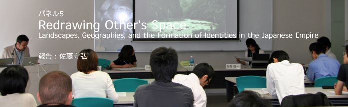
7月1日(日) 13:00-15:00 18号館4階コラボレーションルーム3
パネル5:Redrawing Other's Space: Landscapes, Geographies, and the Formation of Identities in the Japanese Empire
Yokohama Shashin and Representation of Japan in the Late Nineteenth Century Visual Culture/佐藤守弘(京都精華大学)
Landscapes and the Logistics of Vision in Meiji Japan/Gyewon Kim(McGill University)
朝鮮映画の風景と郷土性の問題/金麗実(京都大学・院)
【コメンテイター】安西信一(東京大学)
【司会】佐藤守弘(京都精華大学)
本パネル、"Redrawing Other's Space: Landscapes, Geographies, and the Formation of Identities in the Japanese Empire"は、キム・ゲウォン(マッギル大学)によって企画されたもので、近代日本におけるトポグラフィカルな視覚的表象を考察対象として、表象の実践と地理学的想像力の関係を問うものであった。地理学的想像力とは、人がみずからを時間/空間のなかに位置づける術であり、そのなかでも、「風景」という表象の実践によって社会的、主体的な同一性を作り上げていくプロセスとして捉えられよう。こうした考えのもと、発表者は、それぞれの考察の対象——横浜写真における日本の表象、北海道と韓国を対象とした写真、植民地朝鮮の映画における表象——の分析を通して、帝国的/植民地的な主体が、どのように構築されていったのかを検証した(金麗實の発表を除いて、発表、コメントはすべて英語で行われた)。
まず、佐藤守弘(京都精華大学)が、"Yokohama Shashin and Representation of Japan in the Late Nineteenth Century Visual Culture"と題された発表を行った。それは、横浜写真——19世紀に主に欧米人のための土産物として制作された手彩色写真——を、同時期のヨーロッパの旅行写真と比較するものであった。比較の結果、横浜写真とは、日本という他者の地理学的な情報を、写真というメディアによって可視化したものであり、それはピクチャレスクという規範に枠取られることによって、自然のスペクタクルとなり、「文明化の使命」という標語のもと、植民地帝国が世界を一望の下に収めるプロジェクトの一環をなしていたものであると結論づけた。
佐藤 守弘
キム・ゲウォン(Gyewon Kim、マッギル大学)は、"Landscapes and the Logistics of Vision in Meiji Japan"において、19世紀の終わり頃の北海道の開拓写真と20世紀初頭の植民地朝鮮の写真に注目し、それらがどのように帝国日本の視覚的レジームを構築することに関わったかについて考察を進めた。その両者に見られるものは、写真というメディアが、実証性を具えるメディアとして捉えられることによって、ある種の支配の手段として作用していたということである。とくに俯瞰によって大観的に捉えられた開拓地北海道と植民地朝鮮の写真に着目して、写真の記録性が、どのように「視覚の兵站術」として用いられたかが考察された。
キム・ゲウォン
最後に、金麗實(Kim Ryeo-Sil、京都大学)は、「朝鮮映画の風景と郷土性の問題」において、植民地朝鮮を主題として日本人によって撮られた映画に着目した発表を行った。とくにそれらの映画を巡った朝鮮の「郷土性」に関する言説の流れを精査することによって、植民地と宗主国との差異と同一性を巡る揺れが問題とされた。
金 麗実
それぞれの発表が長引いた結果、安西信一氏(東京大学)によるコメントに十分な時間を取ることができなかったことは残念であったが、氏からは、西洋、あるいは日本による「支配的なまなざし」という概念が、単純かつ図式的に理解されるものではなく、より複雑な揺動を含んだものであることが、ピクチャレスク美学の唱道者とされるW・ギルピンの発言をもとに提示された。見る/見られるの関係が、しばしば静的な構造として捉えられがちであるのに対し、それをより動的なものとして捉えるべきであるというこの提言は、発表者のそれぞれが今後とも考えていかなければならない問題であろう。
佐藤守弘(京都精華大学)
パネル概要
When Karatani Kōjin argues that landscape was discovered at a specific moment in the emergence of interiority, he infers that landscape can no longer be considered in the guise of external scenery alone. Rather, it relates to the discovery of a peculiar modern subjectivity that emerges, becomes constructed, and achieves consolidation by facing the landscape out there. The discovery of landscape was also concurrent with the discovery of the other, which was inevitably objectified and dominated in such subjective formation. Hence it is not a mere coincidence that landscape was discovered in the third decade of Meiji Japan, just at the moment it was forced to encounter Western others, and was obliged to examine its interiority per se. At this very moment, however, another conception of landscape was constructed by means of the thorough scrutiny of others’ space, that is, the colonial others. In this session, we examine how the Japanese landscape was discovered through double or simultaneous encounters with different others, and how this doubleness affords a starting point for the inquiries launched in this session. We attempt to situate the question of landscape historically by mapping out concrete geographies of others’ space, including those of Manchuria, Korea, Hokkaido and various sites within Japan under the gaze of the West. In exploring these different geographies, we aim to articulate how the Japanese Empire achieved its distinctive cultural and national identities through a specific set of spatial discourses and representations.(パネル構成:Gyewon Kim)
Yokohama Shashin and Representation of Japan in the Late Nineteenth Century Visual Culture
佐藤守弘
Yokohama Shashin are the photographic images that were produced mainly in Yokohama from the 1860s to the end of the nineteenth century. Mounted on paper and bound as albums, they were sold as souvenirs for the tourists from the West or exported to Europe and America. In the beginning, the Western photographers such as Felix Beato (1834-c.1903) and Baron von Stillfried (1839-1911) produced such images. Later, Japanese photographers produced colorful hand-tinted photographs. Recently, many books on Yokohama Shashin are published one after another. These books, however, deal with the photographs as historical documents, or "truthful" visual records. In other words, Yokohama photographs are regarded as transparent media and the aesthetic features and ideological and political significance of Yokohama photographs are both unrecognized.
My paper will treat Yokohama Shashin as a form of visual culture produced and consumed in a specific social context. I will suggest the function of landscape representations of Yokohama Photographs was primarily to report the topographical information of the unknown terrain, or Other's site, based on the empirical knowledge of geographical science. Still, the mode of representation was heavily depending on the canon of the picturesque developed in the eighteenth century Europe. Photography was an important component of the newly emerged form of visual culture in the late nineteenth century, namely, tourism in the age of imperialism. The aim of my paper is to place Yokohama Shashin in the context of colonial landscape photography, indicating the relationships between international expositions, tourism and photography.
Landscapes and the Logistics of Vision in Meiji Japan
Gyewon Kim
This paper takes its cue from two different landscapes photographed during the early Meiji period. One was taken by a group of photographers during the Hokkaido Reclamation (1869-1898), while Kotō Bunjirō, a geologist, shot the other during his geographical expedition in Korea (1900-1906). Despite the differences in agencies, locations, and purposes, these two photographic practices share common pictorial qualities, photographic technologies, and instrumental functions. By contrast, however, I focus on the other domain they have in common, that is, the way in which they are engaged in the construction of imaginative geographies of Empire. Emerging from the new fields of the modern sciences and their institutional practices, both landscapes participate in the formation of knowledge, scientific/instrumental discourses, and in the technologies of territorial domination. More importantly, the two landscapes chart the imaginative geographies of Empire by seemingly operating as neutral, objective, and truthful eyes, or ostensibly recording the unknown, untouchable territories of Others. By juxtaposing the landscapes created at Hokkaido and in Korea, I try to problematize a classic perspective on colonial photography, which conceives it as a surrogate for colonial ideology. Rather, it works on a more complex terrain where ideologies of modernity, contrasting hegemonies of vision, and multiple investigative modalities, intersect and become co-extensive with one another. This paper tries to elucidate how the two landscapes get ‘played out’ or represented in this wider discursive space, constituting a specific visual logistics, which serves the imaginative geographies of the Meiji Empire.
「朝鮮映画の風景と郷土性の問題」
金麗実
朝鮮において児童を対象とした宣伝映画が製作され始めたのは、太平洋戦争の戦雲が垂れこめた1940年ころである。日中戦争の直後近衛内閣は「教育審議会」を新設し、戦時体制に応じて教育改革を進めていた。その結果1941年3月1日には日本、朝鮮、台湾で勅令148号の「国民学校令」が公布され、 4月1日から既存の6年制の小学校は初等科6年、高等科2年の国民学校に改変された。
このような体制の変化に従って当時映画検閲機関である朝鮮総督府図書課の嘱託であった在朝日本人西亀元定は、児童向けの宣伝映画『授業料』を企画した。西亀は後に朝鮮総督府の施策に積極的に協力し戦争プロパガンダ映画を作るようになる「高麗映画協会」に『授業料』の製作を委託した。この映画の原作は 1939年光州北町公立尋常小学校4年生の禹壽榮(ウ・スヨン)が書いた同名の綴り方であり、これは朝鮮総督府の機関誌の『京城日報』が主催した綴り方懸賞公募で朝鮮総督賞を受けたものであった。その内容とは、貧しい家の子供である禹少年が授業料を払えずに悩んでいることを知った日本人教師が友情函を設置し募金を集めてくれるという、当時流行の「軍国美談」であった。
1940年5月に封切られた『授業料』においてもっとも興味深いところは、翌1941年4月1日から教えられる予定であった国民学校の地理教科が予め宣伝されていることである。映画『授業料』は原作を脚色して地理授業のシーンを入れ、「内鮮一体」の宣伝を子供に分かりやすく伝えている。この発表では、この地理授業のシーンを総督府の教育制度の改編に鑑みて検討し、そこに描かれた「我が国」の表象を論点にとりあげる。
安西 信一